New map graphics
We created these to show the negative impacts and environmental damage of the proposed A38 expansion after discussions with local politicians who had not seen the planning documents and were unaware of the scheme’s harms.
The scheme’s planning documents are available here for anyone who wants to fact check our work: https://national-infrastructure-consenting.planninginspectorate.gov.uk/projects/TR010022
Email your councillors and MP these maps
You can find their contact details and contact them using: https://www.writetothem.com/
Just write something short in your own words that you object to the A38 expansion, the maps show how damaging it would be and the Government should use the £600 million to fund sustainable transport solutions instead.
Download the map graphics or copy‑paste the links into your emails:

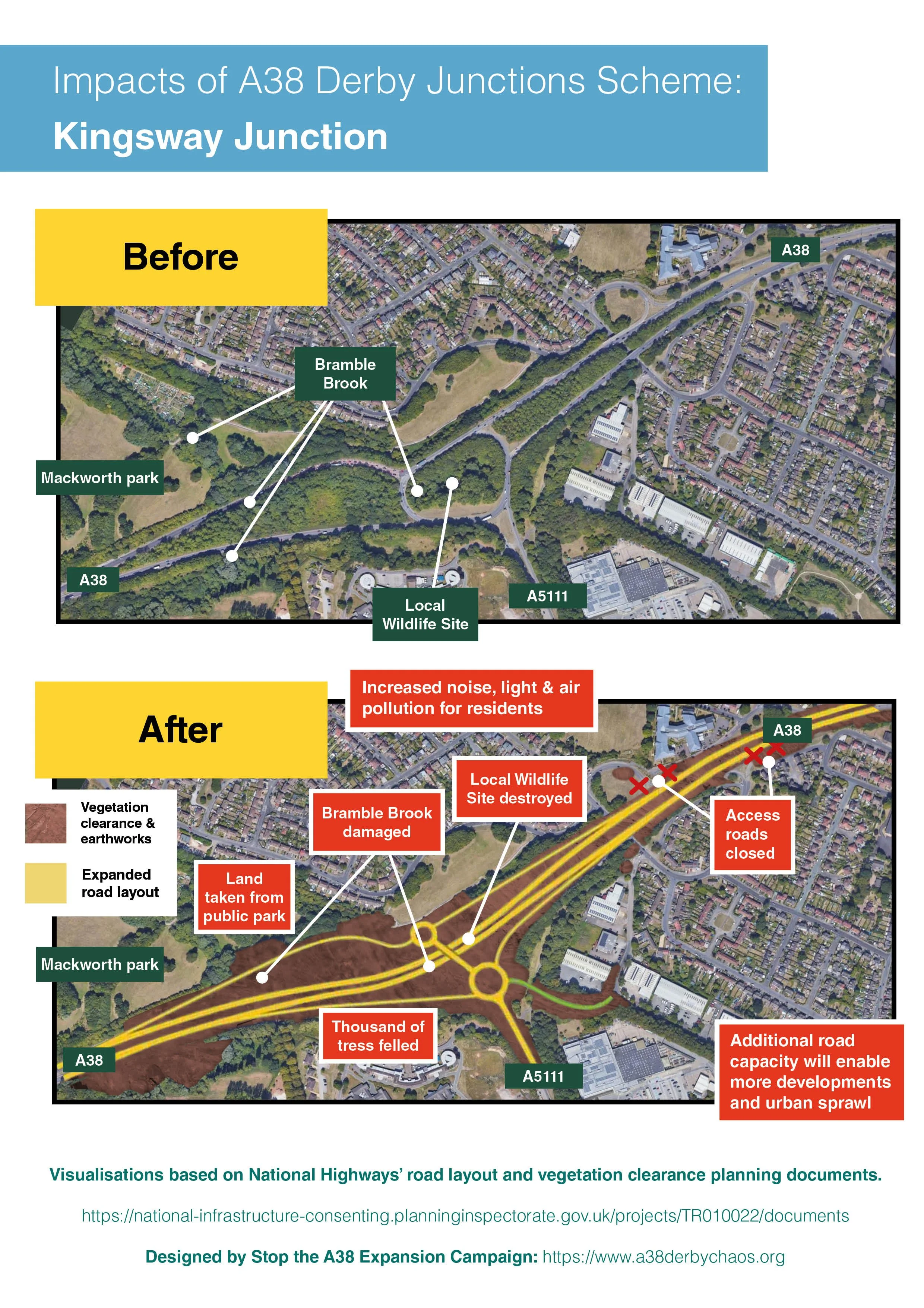
Before-and-after visualisation showing how the A38 Kingsway Junction expansion fells thousands of trees, removes some of Mackworth Park, damages Bramble Brook, destroys a Local Wildlife Site, and increases noise, light, and air pollution for nearby residents.

Before-and-after visualisation showing the destruction of ancient trees, loss of parkland, widened A38, construction in Markeaton Park, and increased pollution affecting residents and the Royal School for the Deaf.
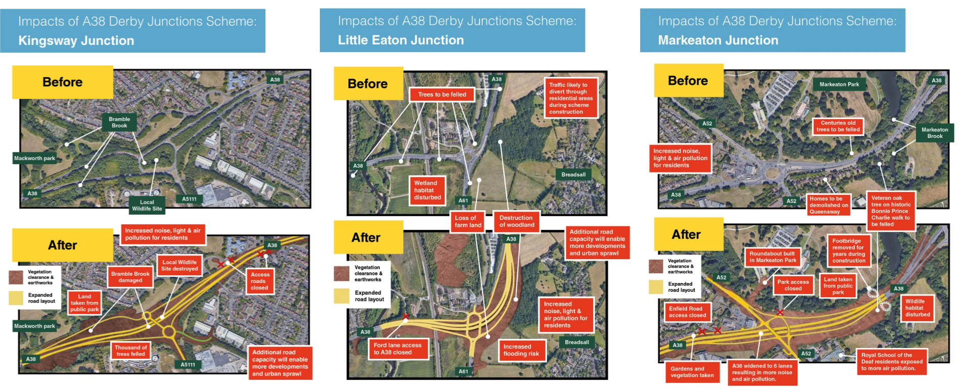
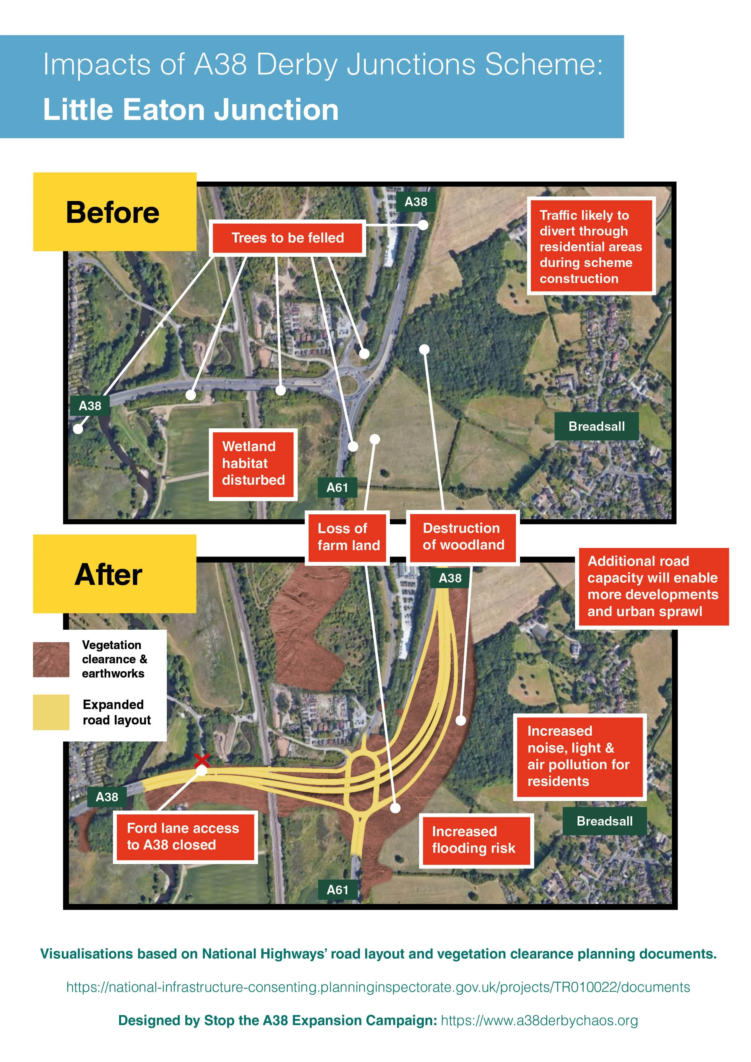
Before-and-after visualisation showing woodland destruction, farmland loss, wetland disturbance, increased flooding risk, and greater pollution around the A38 Little Eaton Junction expansion.